Patrick Kerrin's 2001 Chase Page - 05-24-2001

Just scroll down!


05-24-2001 - Here is my 01z (i.e. the night before) surface analysis. Raw data printouts courtesy the kind folks at the SAT National Weather service forecast Office (actually located in corn fields near New Braunfels, TX). They don't get a lot of chaser visits and were most welcoming! Thanks, SAT NWSFO! Note 50F isodrosotherm from Del Rio TX (KDRT) to just S of Junction TX (KJCT).


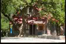
05-24-2001 - one of the nice things about having access to nowcasting support is that if the initiation of deep convection is not likely for a good amount of time, one can explore a little on the way to the Chase Target region. This meant I could enjoy a great Hill Country Drive and visit the beautiful tiny settlement of Gruene, TX near New Braunfels. This is the famous Gruene Dance Hall where lots of Texas Musicians have induced two-steps! Note the cu field is still "flat as pancakes" - initiation was still a long way off!


05-24-2001 - Luckenbach, TX. Was as small as I expected (it's basically a one building town). Various tourists were in attendance, as well as what appeared to be some 'regulars'. Had the opportunity to sit in and strum along on a 12 string with a couple of other guitar players (as I've heard is often the case). First time I have 'jammed' during a chase! Folks were all quite interested in hearing that they would get some rain and thunder later that day (and that sure verified!), and the one (local?) who had already had one too many Budwisers (this was about 3:00 p.m.) was the only down point (as I had also heard is often the case). The town history appears here from the "Luckenbach Moon" newspaper, reprinted here for educational purposes.


05-24-2001 - Here is the 16z sfc map - analyzed in Luckenbach (I wonder if that is a first on a chase?). Generally improved moisture pattern along with reasonable deep layer shear and favorable lapse rates. Headed to Fredericksburg, TX for last gas up and food. Mistakenly targeted N of Fredericksburg (area between Fredericksburg and Llano) based on E wind at Junction and little E-W surface troughs. Saw convection going up to the W and got a hold of Lon Curtis who confirmed that initiation was NW of Junction heading SE. I high-tailed W on 290, and then S on 479, W on I-10, and then W on 41 (many thanks to Lon for the expert navigation - that was key to getting ahead of these cells!). Passed under the anvil of the weak E cell with the strong Junction storm coming into view to the NW (which was apparently quite nice on radar see below).


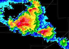
05-24-2001 - KSJT Reflectivity at 2319z - 'Flying Eagle' reflectivity pattern along Sutton/Kimble county line (near Roosevelt)!


05-24-2001 - N.B. Times are pending for all images on this trip - until I can review my video - which I cannot do as my VCR will only switch to 'Line In' with the original remote which went kaput years ago. Got to the junction of 41 and 377 and was a little confused. The image to the left is was what was to my W and appeared to me at the time as new backbuilding development. Headed NE a few miles on and saw the updraft (see below). Although this is, to me, an aesthetically appealing high based updraft with precip shafts - but it probably kept me from seeing what was off to the W and NW.


05-24-2001 - This is the updraft that I have described to some as 'rain wrapped'. I now realize this was very probably the middle cell seen in the KSJT Reflectivity at 2345z (see below). I also now realize that I was azimuthally fouled up! I though, at the time, that I was looking NW at the cell coming down from Junction, TX, and was, in reality, looking NE.


05-24-2001 - KSJT Reflectivity at 2345z - Hook echo extending SW from Sutton/Kimble/Edwards county line 'triple point'. My post mortem shows I was likely focusing on the weak 'middle' cell when I headed up 377 from the 377/41 junction discussed above).


05-24-2001 - KSJT Reflectivity at 2351z Again I will have to confirm where I was at exact times from the video, but my best estimation is during this period I was in and SE of Rocksprings (sirens going) and did not see the action to the NW up 55. All I ever got in Rocksprings were outflow up to about 30 knots. I headed back to 41/377 where I ran into Dave Gold and Roger Hill and Silver Lining Tours. After some discussion, they decided to go off after the LP cell to the SE and I wanted to take a shot at the distant activity to the NE in Kimble county. We apparently both were satisfied with the outcomes, but in my case the sunsets and not the (unreachable) storms to the NE and E. I also recall speaking to Lon around this time and he mentioned the cell to the W/NW but we agreed that it may not be catchable/might eat anyone on 55.


05-24-2001 - Backtracking on 41 *may* have been a choice that *may* have got me back on the Kimble county storms (even for a little lightning opportunity). I chose to take 377 and got into a ton of hills with winding narrow pavement with very few good pull off options. There were a number of truly gorgeous sunset scenes and I couldn't find a place to stop. I did get this one and the one below (which I am very happy with!).


05-24-2001 - This is looking up a hill and taken hand held at 1/30 second, as it was so nice shining on the mammatus - but it was starting to wane! When I got a chance to pull over I just took it - there was no time to put up clamps and cable release. And it turned out! This is, to me, a little reminiscent of a vintage Gibson Les Paul guitar with a Sunburst finish!!! The colors are as it was - there is no alteration to this image - and it faded very quickly after taking the image! This was a year where I had two instances where I took a chance and handheld on good ops (with success) but one other op between the two successes where I just didn't take the chance and focused on shooting video. Lesson: always try!


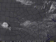
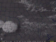
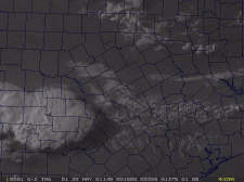
05-24-2001 - First in a series of hi-res visible satellite images of the convective evolution. At 2231z.


05-24-2001 - At 2301z.


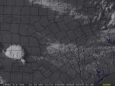
05-24-2001 - At 2345z.


05-24-2001 - At 0015z.